Question

ArcGIS integration - Carmenta or Esri

  • 30 January 2024
  • 8 replies
  • 94 views

Userlevel 3
Badge +4
  • Sidekick (Customer)
  • 15 replies

Hi,

I am looking for information and experiences around ArcGIS integrations in IFS Cloud (customer is looking at doing this on 23R2).

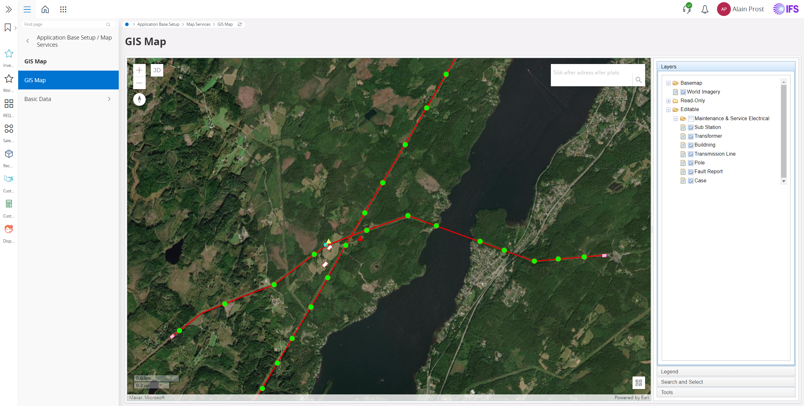
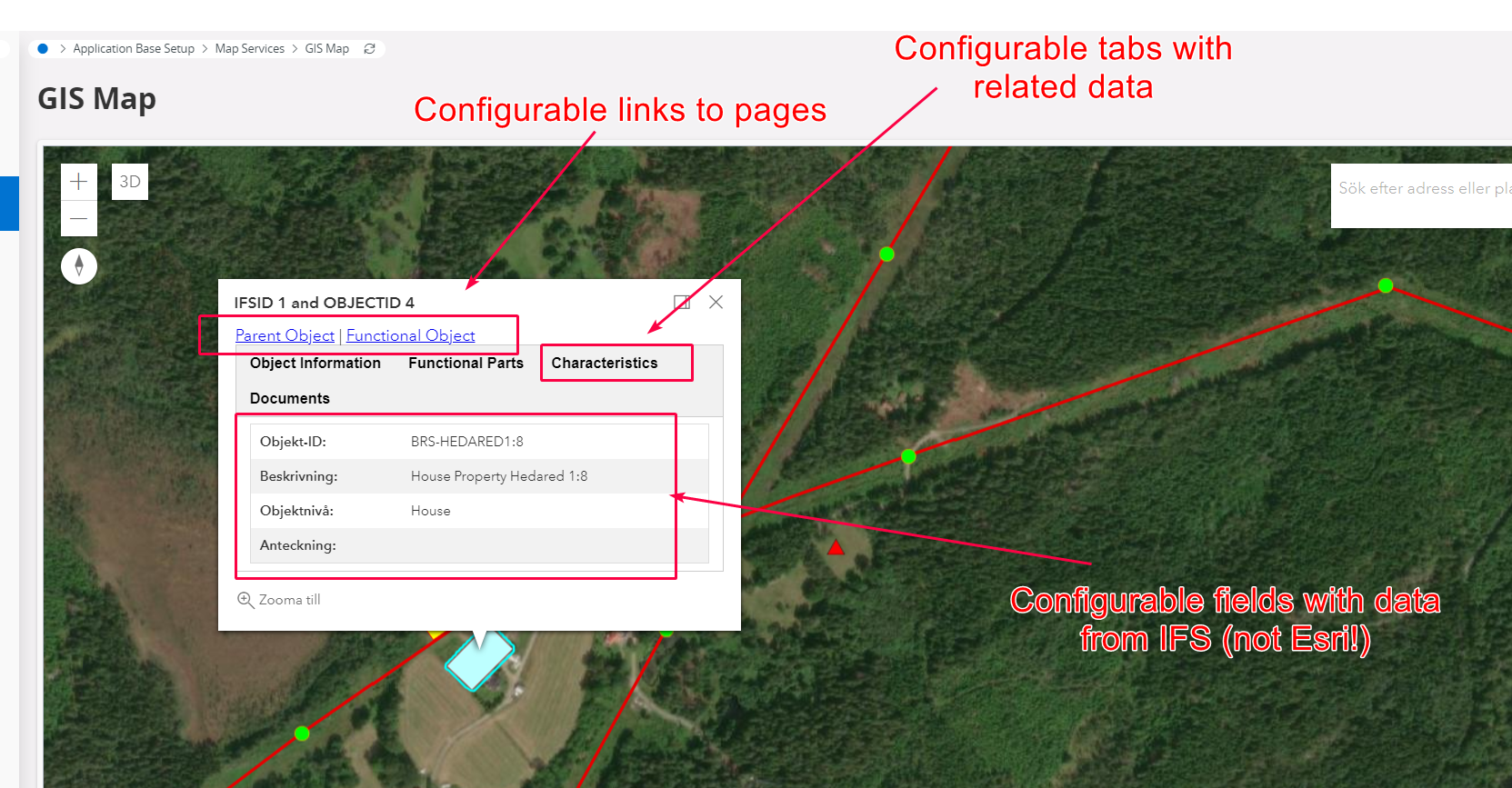
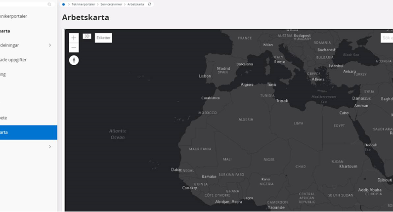
  • Can I find a recorded demo or ppt how the UX looks like in Aurena (any cloud version)?
  • Anyone who have looked at integrating with Carmenta or even better done it?
  • Experiences and thoughts in terms of complexity, features etc?

@Anders Jansson @Mathias Dahl


8 replies

Userlevel 7
Badge +30

Hi @Tor , thanks for asking here!

@Frank Sveen Do you have anything to share from your GIS implementations?

As for the complexity, the GIS integration / GIS Map is quite capable and you can set up a quite nice solution, and especially if you have competence on ArcGIS already.

The best starting point to learn about the GIS Integration is the IFS user documentation:

https://docs.ifs.com/ifsclouddocs/23r2/ProcessModels/Process_Model/GISMapObjectConnection.htm?StandAlone=true

It’s a step by step process and contains all you need to know about GIS Integration in IFS. It's also good to have a look at the "about" documents GIS Integration and GIS Concepts as a starting point. Both are linked to from the same process model.
 

Userlevel 7
Badge +30

Screenshot from 23R2:


Userlevel 7
Badge +30

Configurable object information dialog (different looks for different entities):


Userlevel 3
Badge +4

Thanks for sharing this very useful info @Mathias Dahl , I will also reach out to @Frank Sveen.


Without digging into too much technical details, would this capability allow the IFS user to display Objects and Work orders on the map as per the above and filter the same byt the various standard and possibly customised/configured fields added to the object/work order?  

/Tor

Userlevel 2
Badge +6

Our experience is that to fully utilize the ArcGIS integration you need asset registries in sync between IFS and GIS. Data quality is extremely important to fully utilize the integration.


Also how the ArcGIS  layers are configured are important,


//Anders

Userlevel 7
Badge +30

Thanks for sharing this very useful info @Mathias Dahl , I will also reach out to @Frank Sveen.

/Tor

> would this capability allow the IFS user to:

> display Objects and Work orders on the map as per the above

Yes.

> and filter the same byt the various standard

You need to explain what that means exactly, but I think the answer is no. What I can say is that we can only filter map objects based on attributes in Esri/ArcGIS. We have an attribute search feature for that, which searches in Esri.

> and possibly customised/configured fields added to the object/work order?

As I remember it, the object information dialog you can see in the second screenshot can display values from custom fields in IFS.


Userlevel 3
Badge +4

May I ask a related question that may handle a big part of the business requirement @Mathias Dahl.

Is it possible to extend/modify/configure the IFS standard functionality which (as explained by our IFS implementation partner) allows us to display work orders assigned to a technician in the portal on a map as per the below. We would like to be able to filter tasks/orders in an overview/list and then select a number of records (with coordinates inherited from the object connected) and show these on the built-in map.  Feels like IFS have provided a great capability but only enabled in in a few rather limited use cases.


Userlevel 7
Badge +30

It might be possible to do what you want as a customization, but we use technology under the hood that most SEs might not be familiar with. There will be some Aurena/Marble development, which is fine, possibly some PL/SQL changes as well, but the complex parts is changing the map, which is implemented as an Aurena plugin. It's some JavaScript and HTML code and it needs to take input from that card you showed there, or from some list. It might not be hard, conceptually, but it might be hard because you need certain expertise and the placement of the map source code also does not make things easier.

So, can be done, but will take a while. GIS Map might be easier to work with here...
 

Reply