We would like to view on a Map, all the Functional and Serial Objects, and their operational status for instance. The environment is IFS Cloud 21R2.
We set up the GIS Map with a base map and a layer pointing to the LU for these IFS business objects.
We can see the layers on the Map but no “dot” for the IFS business objects, even though these objects have a Map position linked to them.
Are the IFS Objects with their Map position not enough by themselves to be displayed on the GIS Map ?
Is there antoher required setting ?
Kind regards
Lénaïc
Best answer by Mathias Dahl
Hi,
Thanks for posting your question here.
| We can see the layers on the Map but no “dot” for the IFS business objects, even though these objects have a Map position linked to them.
Since both map positions (what you talk about that you have on your objects) and GIS Maps are about "maps", it's easy to think they are part of the same solution. They are not (unfortunately.)
GIS Map is a map showing data from Esri's ArcGIS platform. It seems you have already been able to add a few such layers in the map, great.
In order to see anything on the map, there needs to be data in those layers, and that data has no relation with the map positions that are stored in IFS. The positions shown in GIS Map needs to come from Esri/ArcGIS layers.
You can use the general attachment map in Aurena to see map positions stored against objects in IFS. Here is an example from 21R2 where a map position is connected to a customer:
The problem with this general map is that it only shows the map positions for one object and it also does not show any interesting information.
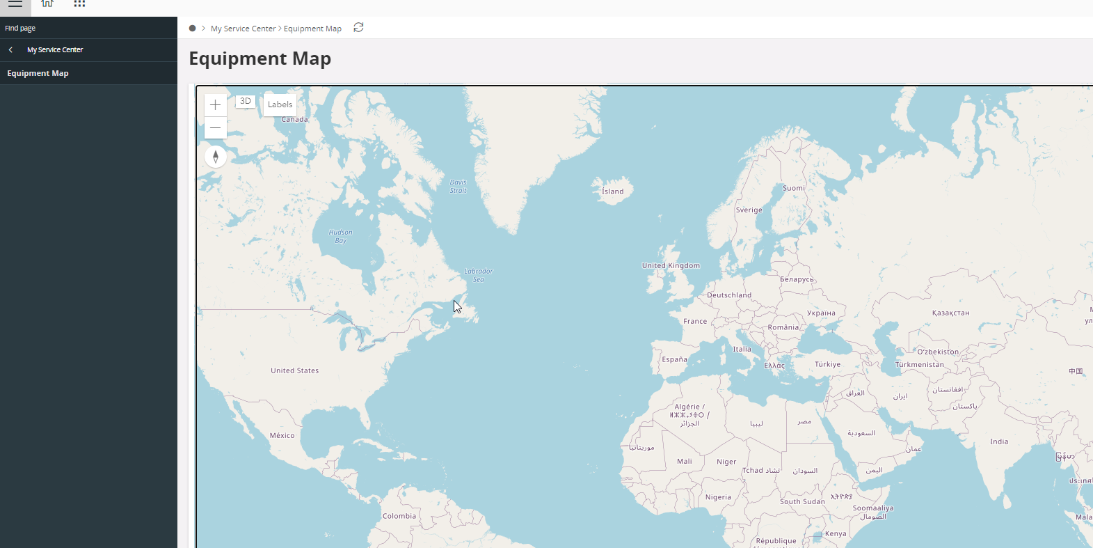
We have on the other hand some custom maps for equipment objects in the B2B area:
But none of them show the status on the map, only points and the object IDs I think (but status can be shown with a small modification). I tried to view those maps now but it seems there is no map positions or really objects that my user is responsible for that has map positions:
If you need advanced mapping, GIS Map is probably the way forward. You cannot see the status directly on the map, but you could see it when clicking an object on the map and, if you make a more advanced integration you could have points, lines etc be colored in different ways depending on, say, the status of an object.
A post here is not the right place to explain how to do all that. If you have a customer interested in this you need to make an investment and learn more about the GIS integration by reading up on our documentation on the subject. You also need to learn at least some basics of ArcGIS, since there is where the data is that is shown on the map.
In our internal Workplace group on GIS/Maps and BIM you can find a lot of examples and also videos on some parts of the setup flow for GIS Map.
| We can see the layers on the Map but no “dot” for the IFS business objects, even though these objects have a Map position linked to them.
Since both map positions (what you talk about that you have on your objects) and GIS Maps are about "maps", it's easy to think they are part of the same solution. They are not (unfortunately.)
GIS Map is a map showing data from Esri's ArcGIS platform. It seems you have already been able to add a few such layers in the map, great.
In order to see anything on the map, there needs to be data in those layers, and that data has no relation with the map positions that are stored in IFS. The positions shown in GIS Map needs to come from Esri/ArcGIS layers.
You can use the general attachment map in Aurena to see map positions stored against objects in IFS. Here is an example from 21R2 where a map position is connected to a customer:
The problem with this general map is that it only shows the map positions for one object and it also does not show any interesting information.
We have on the other hand some custom maps for equipment objects in the B2B area:
But none of them show the status on the map, only points and the object IDs I think (but status can be shown with a small modification). I tried to view those maps now but it seems there is no map positions or really objects that my user is responsible for that has map positions:
If you need advanced mapping, GIS Map is probably the way forward. You cannot see the status directly on the map, but you could see it when clicking an object on the map and, if you make a more advanced integration you could have points, lines etc be colored in different ways depending on, say, the status of an object.
A post here is not the right place to explain how to do all that. If you have a customer interested in this you need to make an investment and learn more about the GIS integration by reading up on our documentation on the subject. You also need to learn at least some basics of ArcGIS, since there is where the data is that is shown on the map.
In our internal Workplace group on GIS/Maps and BIM you can find a lot of examples and also videos on some parts of the setup flow for GIS Map.
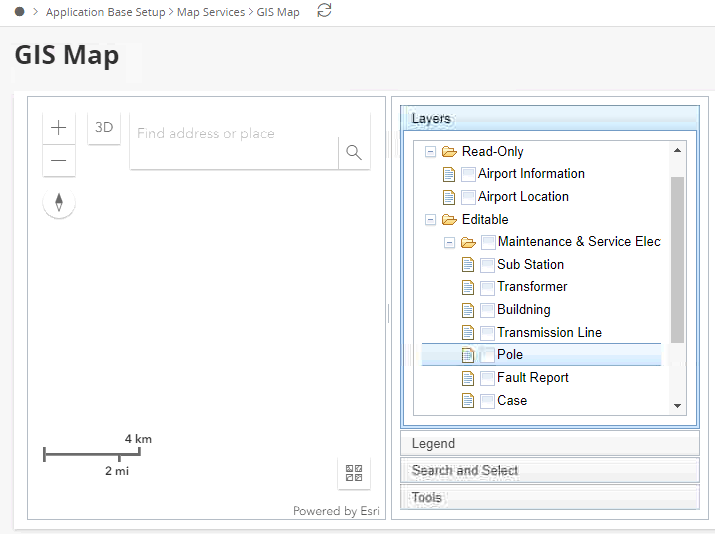
My response is very basic, but hope the Layers ( which you indicated are preconfigured and available ) , have been selected as well in the Layers.
As you can see from the screen shot, you can decide what needs to be shown on the map - which can be different for different users.
Once you select the different options, which you want to see, then only those cases, will appear as DOTS ( unfortunately the second screen shot got lost) , but please check, and hope that works for you .
If you want to get a feeling for how the integration works, you can easily add objects from ArcGIS (I assume you have access to ArcGIS tools or ArcGIS Online), then connect them in IFS. Each layer needs an IFSID column (number) in order for that to work. The documentation has a lot more information on this, and some of the video recordings might too.