Question

GIS Zoomfactor in page Functional Object

  • 2 February 2022
  • 5 replies
  • 62 views

Userlevel 3
Badge +8

Dear all,

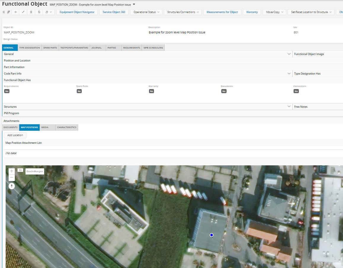
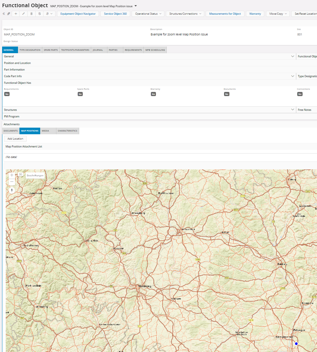
is it possible to predefine the zoom factor for GIS and Map Positions?

We would like to pre define a closer zoom than Global or Country.

Where is that to be pre-defined?


Thanks in advance.

DADUDE


This topic has been closed for comments

5 replies

Userlevel 7
Badge +30

The only way you can affect the default zoom is by opening GIS Map as the end-user, then right click and click Save start position. Then, when the map opens after “jumping” to it from an object, it should default to that position, which includes the zoom level.

If only a point object is selected and jumped with, we cannot know how much to zoom, but if you navigate with a polygon, line or multiple point objects, we try to zoom in such that they fit on the screen.

There are no other settings to this. We could add some of course, if we could find a good way to configure it (should it be per layer, per LU, or per something else?)


Userlevel 3
Badge +8

The zoom factor in the Functional Object:


If there is no postion given the zoom level is world and if there is a position given, there is a standard zoom level:

The zoom level should be the last level entered by the enduser.


Is there a possiblilty for FO?

Userlevel 7
Badge +30

Thanks for testing!

Is there a possiblilty for FO?

Sorry, I don’t understand what you are asking.

What I can say is that I think GIS Map should use the zoom level given by the start position, if it has been set by the user. If possible, that is. Perhaps there was a problem implementing that, perhaps we forgot, or perhaps it is a bug.

A small tip on how to quickly zoom in the map: instead of using the scroll wheel, you can keep the Shift key pressed on the keyboard while drawing a rectangle using the mouse on the map. Then the map will zoom in to show that area.


Userlevel 3
Badge +8

Hello Mathias,

the issue or question is regarding the map behaviour in the Functional Object Map Position. 

If there is no position the zoom level is like this:

If you add a Location via RMB “Add Position” the zoom level is the users selected zoom level:


If you exit the view and re-enter is the zoom level is like this:


The question is:

Can that behaviour be modified:

  • closer 1st zoom level before the position got entered.
  • saving the user defined zoom level.
  • closer 2nd zoom level after position got entered.

The example is available on the interlnal 21R2 LKP TST.

I hope the question is now clear. Otherwise please make it possible to coordinate an internal appointment.


T&R

Userlevel 7
Badge +30

Oh, I am sorry, I thought this was about GIS Map. The word “GIS” got me. My mistake.

I had a quick look at the source code for that map. There is no way (no settings) for the user to control the default zoom level.

For the scenario where there is only one object, we default to zoom level 10.

For the scenario where there are more than one object on the map, or position, we try to zoom in to fit them all in the map view.

You would need to make a customization of that map to control the zoom level.

You could add an idea here in Community to get some settings or commands in this area.