Dear All
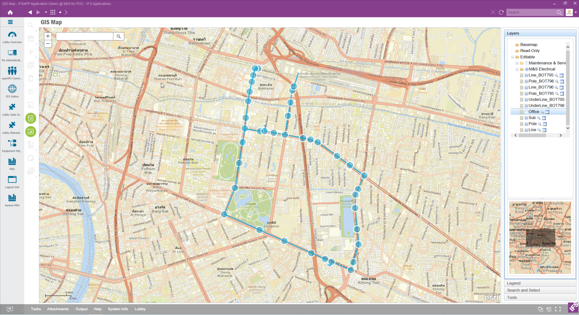
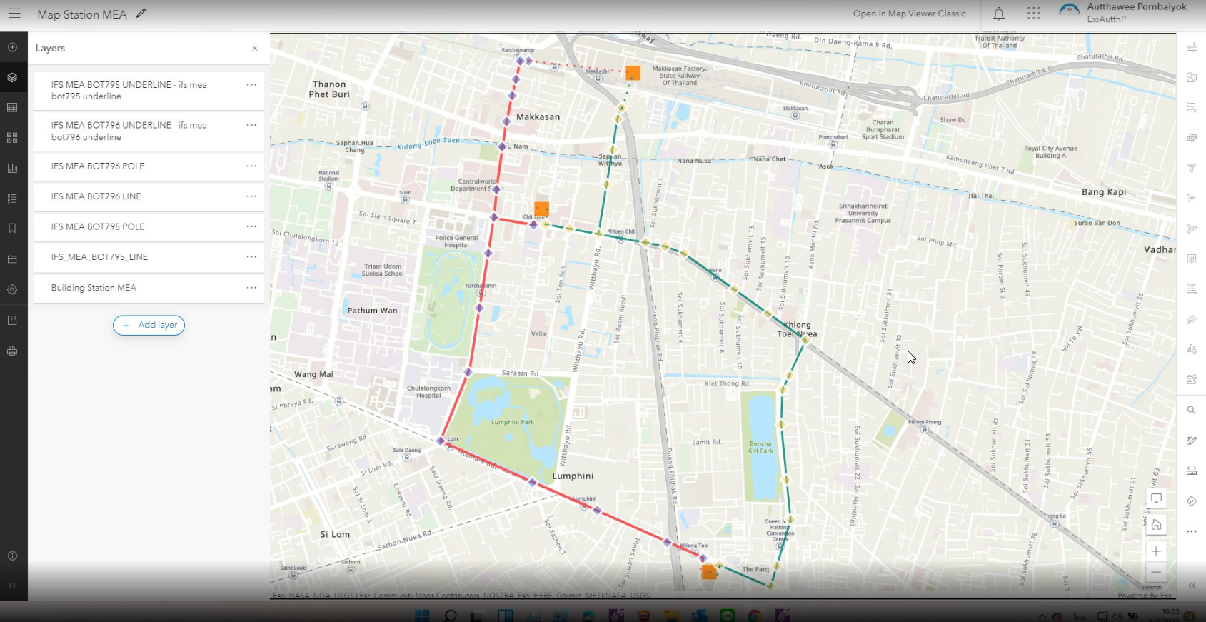
I have problem about creating symbol in GIS but it is not applied in GIS Map that is opened in IE or AURENA. As you can see in the picture below, IFS App (PIC 1) show only default symbol not symbol I create in GIS (PIC 2).
PIC 1
PIC 2
Dear All
I have problem about creating symbol in GIS but it is not applied in GIS Map that is opened in IE or AURENA. As you can see in the picture below, IFS App (PIC 1) show only default symbol not symbol I create in GIS (PIC 2).
PIC 1
PIC 2
After you changed the layer in ArcGIS, did you make sure to save it? What is important is that the symbology is changed on the layer itself, and not as a property of the webmap itself. What happens if you open the layer URL in a web browser and look at the layer there, without using any webmap?
Can you share the layer, or a copy of it, with us?
Dear Mathias
Thank you for your replying, As you see this is the URL I use for mapping in IFS
https://services8.arcgis.com/DSacWv0Lx5fW0Qzm/ArcGIS/rest/services
and this is WEB Map that include all layer in URL above
However, I can only change symbol in WEB Map but not in the Layer itself.
When I open one of the pole layers there, the symbol looks like it does in IFS:
Since IFS does not have explicit support for webmaps we can only show the layer using the symbol that exists in the layer itself. We cannot fetch any custom symbol defined in the webmap.
You need to make sure the symbol is actually changed on the layer itself. I suggest you open the layer NOT within the context of the webmap.
Dear Mathias
May you suggest me how to change symbol style on the layer itself, because when I change and save GIS always ask me to save with new name and finally I have another Webmap.
As the picture below is process I edit symbol style.
Pic 1 Change symbol style
Pic 2 Save
Pic 3 Receive new Webmap
I think your problem is that you are saving the map (the webmap) where you instead should have saved the symbology changes on the layer instead.
Dear Mathias
Thank you very much for your help, I can do it now by change symbol at the first time and plot symbol on the map before saving layer.
/Nithipatch
I think your problem is that you are saving the map (the webmap) where you instead should have saved the symbology changes on the layer instead.
Thank you very much for your help, I can do it now.
/ Nithipatch
Great!
Could you explain in more detail what you did to resolve the problem? Was it to save the changes to the layer rather than the changes to the map?
Great!
Could you explain in more detail what you did to resolve the problem? Was it to save the changes to the layer rather than the changes to the map?
Yes, please see Clip VDO in the attached file (File : Modify Layer)
I found that we can change any symbol and plot on the map again and again as we need but finally we have to save layer with the same name.
Remark:
Picture 1
Picture 2
Thanks! I hope this post will be a help for others that wants to try the GIS integration.
Enter your E-mail address. We'll send you an e-mail with instructions to reset your password.