")

Dear All
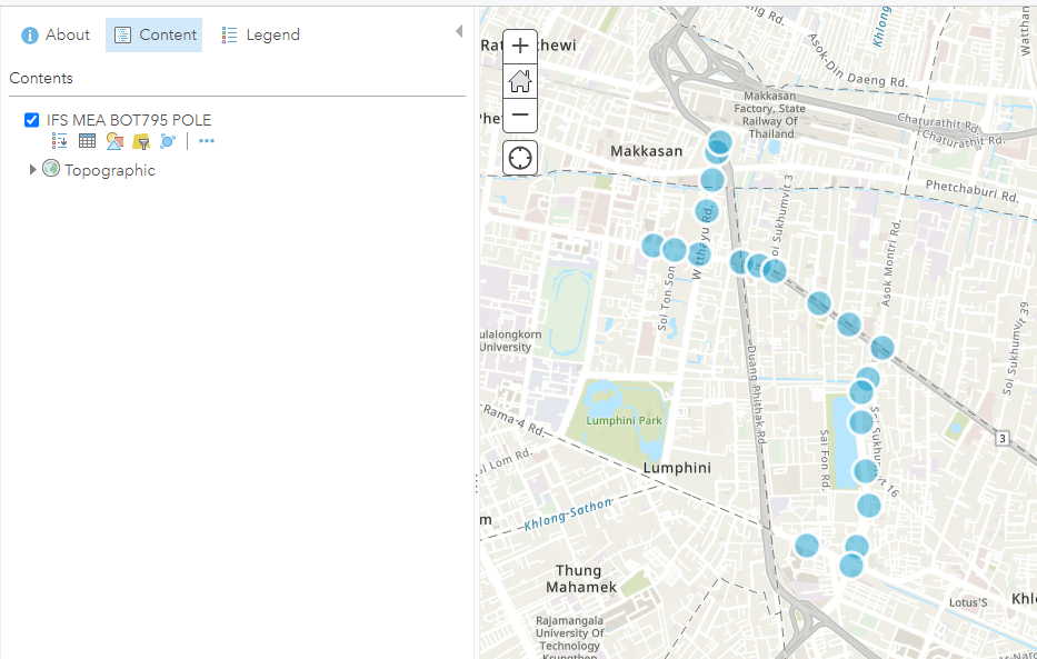
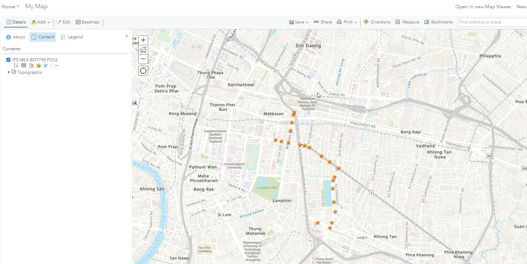
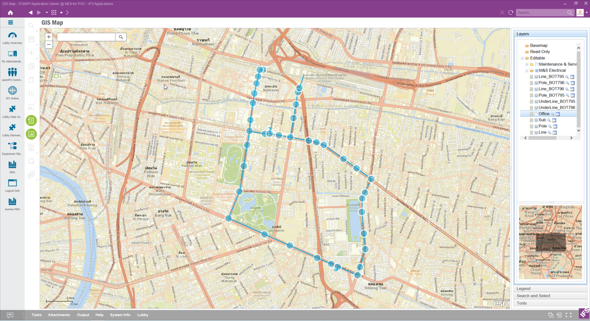
I have problem about creating symbol in GIS but it is not applied in GIS Map that is opened in IE or AURENA. As you can see in the picture below, IFS App (PIC 1) show only default symbol not symbol I create in GIS (PIC 2).
PIC 1
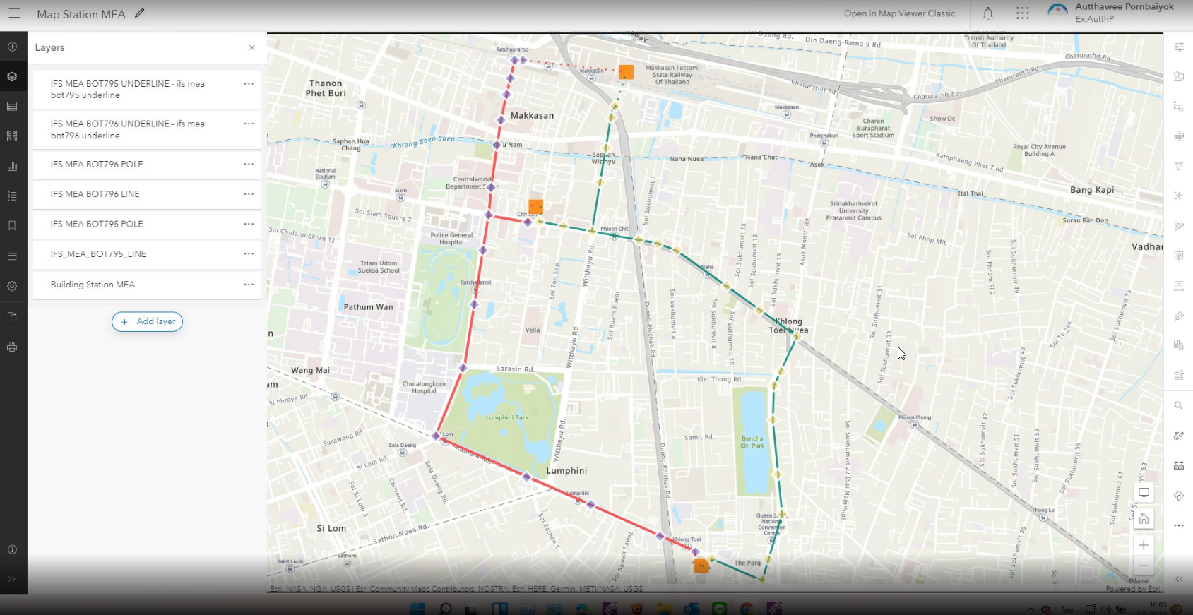
PIC 2

Dear All
I have problem about creating symbol in GIS but it is not applied in GIS Map that is opened in IE or AURENA. As you can see in the picture below, IFS App (PIC 1) show only default symbol not symbol I create in GIS (PIC 2).
PIC 1
PIC 2
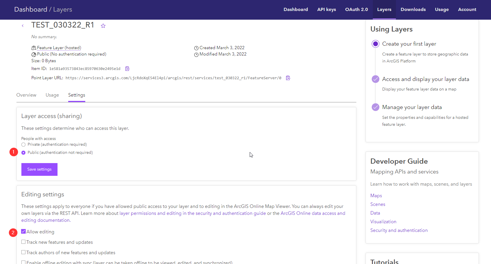
Best answer by Mathias Dahl
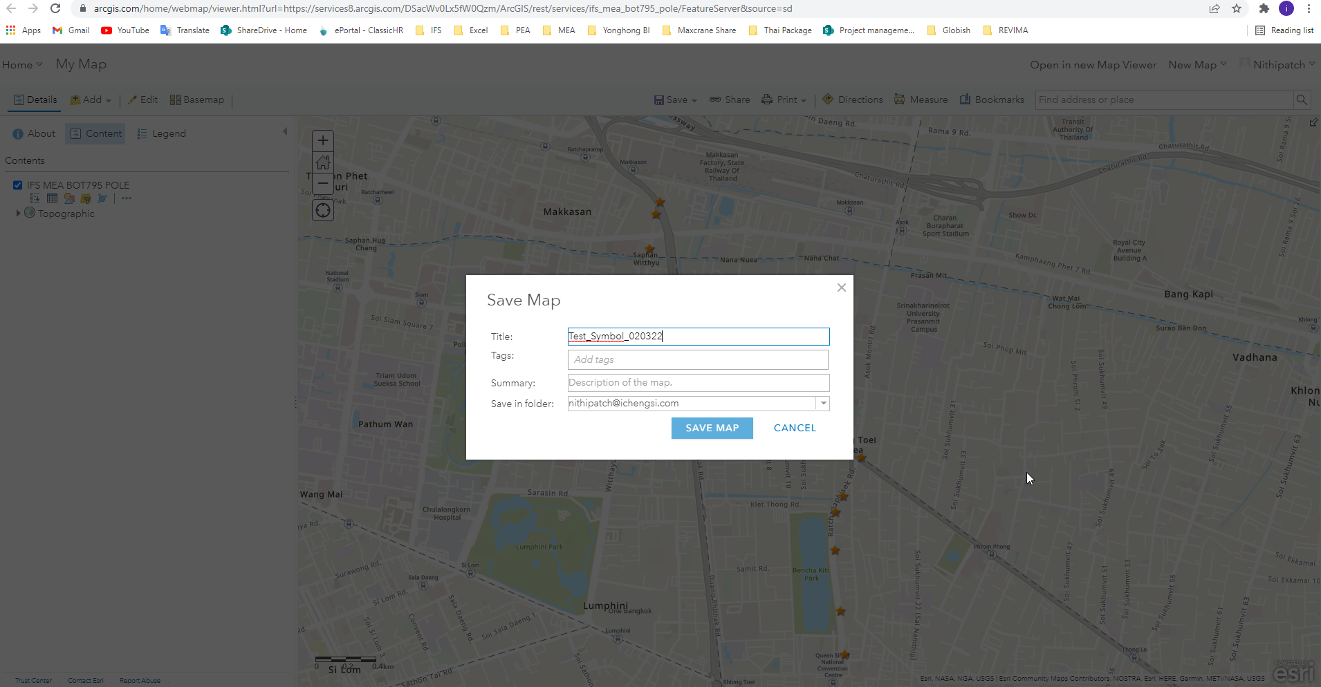
I think your problem is that you are saving the map (the webmap) where you instead should have saved the symbology changes on the layer instead.
Enter your E-mail address. We'll send you an e-mail with instructions to reset your password.
")