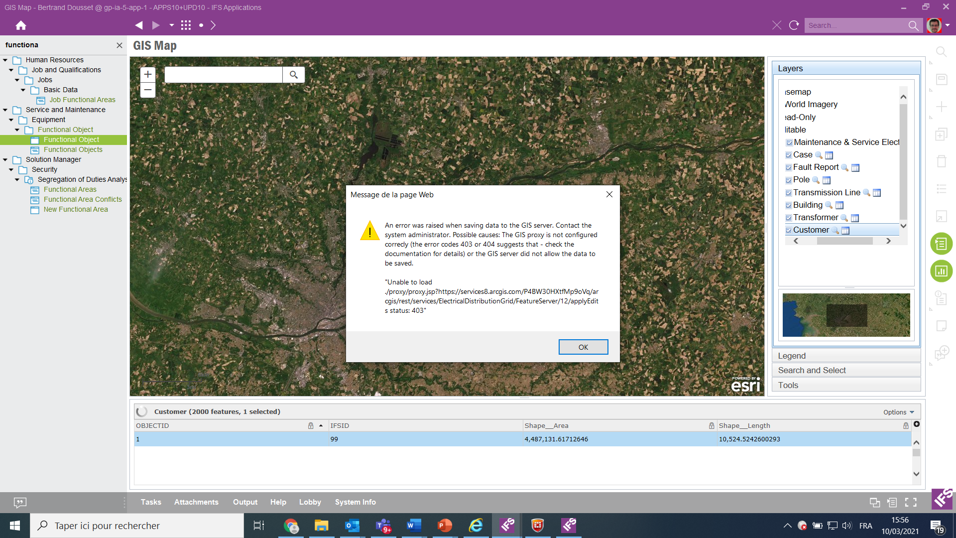
You could try adding that base URL as well. When it comes to basemaps the proxy is not used much, but I think it might be used when the map loads, to get the metadata for it.
As for understanding how it all works, the documentation should explain it. This is the main document:
http://docweb.corpnet.ifsworld.com/ifsdoc/Apps10/documentation/en/ObjectPositioningGISMap/AboutGISConcepts.htm?StandAlone=true
Search for “Configuring the GIS proxy” on that page to see how the proxy can be configured.
When you install IFS, the proxy contains a quite good setup so that the standard basemaps should work well, and it also contains some examples that you can tweak. It seems this has been messed up in your installation. Here is the default proxy configuration:
<?xml version="1.0" encoding="utf-8" ?>

<ProxyConfig allowedReferers="*"

             logFile="proxy_log.log"

             mustMatch="true">

  <serverUrls>
    <!-- For basemaps on ArcGIS Online to work -->


    <serverUrl url="https://services.arcgisonline.com/ArcGIS/rest/services"

               matchAll="true"/>
    <serverUrl url="http://services.arcgisonline.com/ArcGIS/rest/services"

               matchAll="true"/>
    <serverUrl url="https://server.arcgisonline.com/ArcGIS/rest/services"

               matchAll="true"/>
    <serverUrl url="http://server.arcgisonline.com/ArcGIS/rest/services"

               matchAll="true"/>
    <!-- The following URL is useful to have when the user opens a

         secure layer and where the proxy has no user name and

         password for it. In that scenario, the user will be prompted

         for username and password in the map, and that will in turn

         be passed to the proxy which will generate a token using the

         URL below. Similarly, if using an internal ArcGIS server with

         secure layers, the URL to that token generator must be added

         in this file as well. Modify the INTERNALSERVER example below. -->
<!-- Allow generating tokens on ArcGIS Online. See explanation above. -->
    <serverUrl url="https://www.arcgis.com/sharing/generateToken"

               matchAll="true"/>
    <!-- To allow a certain service with the name MYCLOSEDSERVICEID on ArcGIS Online

         The username and password are used to generate a short-lived token used to

         login the user automatically. -->
    <serverUrl url="https://services.arcgis.com/MYCLOSEDSERVICEID/ArcGIS/rest/services"

               matchAll="true"

               username="myusername"

               password="mypassword"/>
<!-- To allow generating tokens on an internal server. See explanation above. -->
    <serverUrl url="http://INTERNALSERVER:6080/arcgis/tokens/generateToken"

               matchAll="true"/>
    <!-- To allow a certain service with the name SERVICENAME on an internal server

         The username and password are used to generate a short-lived token used to

         login the user automatically. -->
    <serverUrl url="https://INTERNALSERVER:6080/ArcGIS/rest/services/SERVICENAME"

               matchAll="true"

               username="myusername"

               password="mypassword"/>
  </serverUrls>

</ProxyConfig>

<!-- See https://github.com/Esri/resource-proxy for more information -->
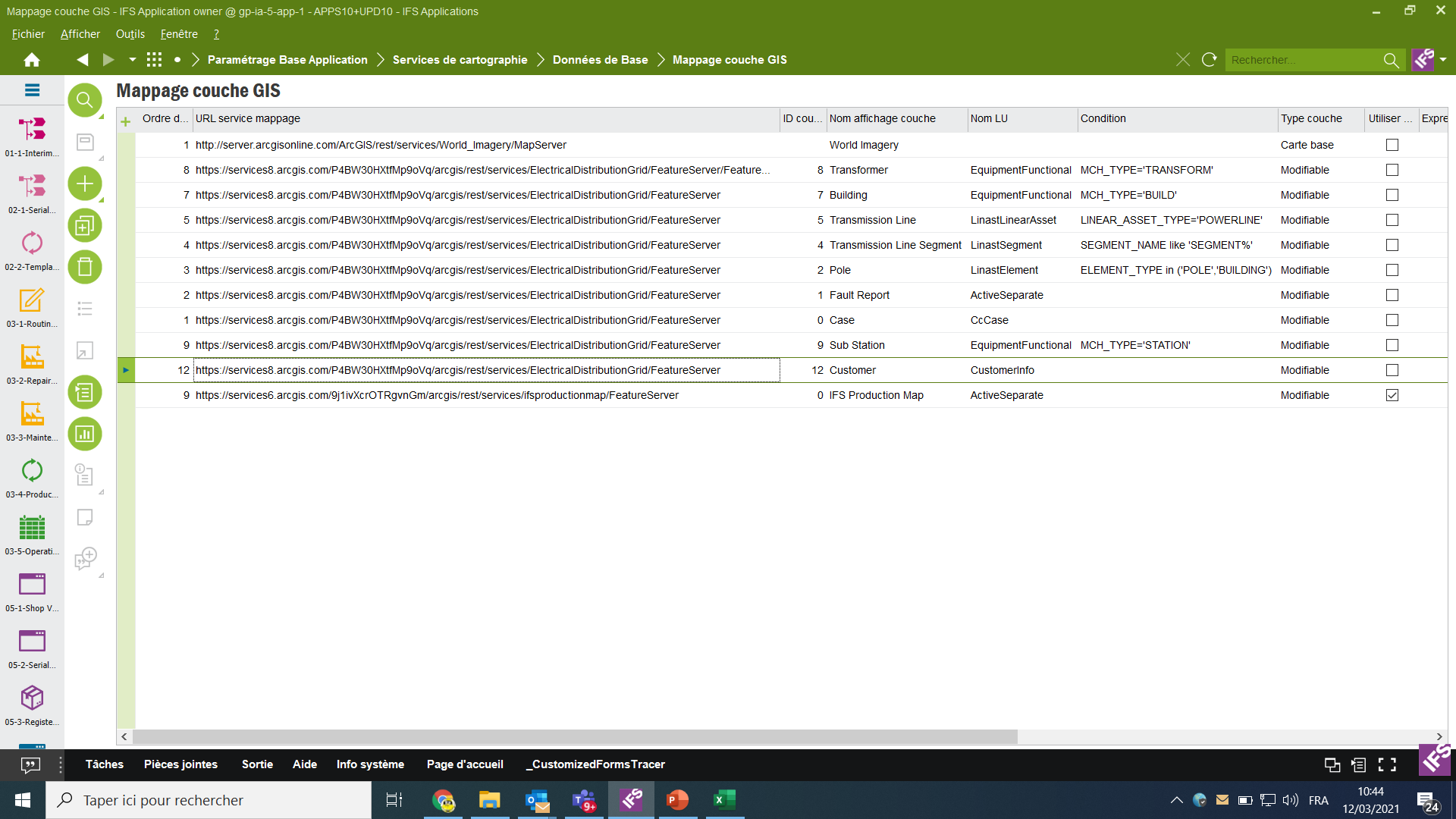
Perhaps you should restart fresh with the above and add your URLs on top of it?